RESEARCH FOREST PIPELINE
Below is the link to the HGSD interactive map:
In the early 2010s, a 48-inch surface water pipeline was installed along Research Forest Drive to deliver treated Lake Conroe water to residents in South Montgomery County.
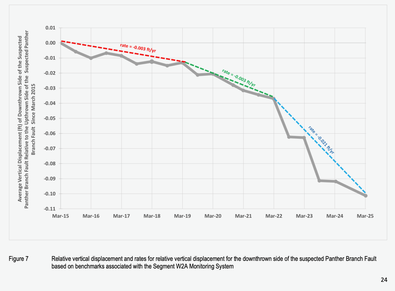
Because this pipeline crosses several known fault lines, the San Jacinto River Authority conducts annual land surveys near many of the fault crossings. After each survey, the results are sent to INTERA, a consulting firm that analyzes whether the land surface is moving near the pipeline.
Over the past 11 years, the quality of these reports has improved. More recent reports include vertical displacement charts and maps showing the survey monuments used to measure ground movement.
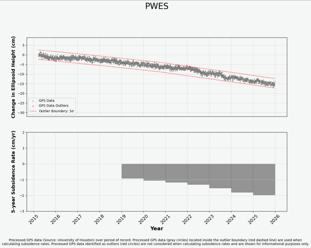
In addition to SJRA’s fault monitoring, the Harris-Galveston Subsidence District provides an interactive map showing land-surface elevation changes in the area. That data also shows differential subsidence near the pipeline.
For example, the PAM 13 monitoring station, located east of the Panther Branch Fault, shows a subsidence rate of 0.62 cm per year. Nearby, the PWES CORS station shows a subsidence rate of 1.97 cm per year. That means PWES is sinking at more than three times the rate of PAM 13.
This difference matters because a large buried pipeline may not respond well when the ground beneath it moves at different rates across short distances, especially near active or historically active faults.
Highlights from the links provided above include, PWES detailed measurements and the vertical displacement map at the Panther Branch Fault